Colinroobie
| Colinroobie New South Wales | |
|---|---|
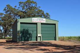 Rural Fire Service shed | |
| Coordinates | 34°32′19″S 146°35′36″E / 34.53861°S 146.59333°ECoordinates: 34°32′19″S 146°35′36″E / 34.53861°S 146.59333°E |
| Postcode(s) | 2700 |
| Elevation | 291 m (955 ft) |
| Location |
|
| LGA(s) | Narrandera Shire |
| County | Cooper |
| State electorate(s) | Cootamundra |
| Federal Division(s) | Riverina |
Colinroobie is a rural community in the central part of the Riverina in southern New South Wales, Australia. Previously referred to as Bents Hill its name was changed in January 2005.[2]
It is situated by road, about 24 kilometres (15 mi) north from Narrandera and 28 kilometres (17 mi) south from Barellan.
Colinroobie Post Office opened on 5 November 1895 and closed in 1952.[3]
Notes and references
- ↑ Travelmate Archived March 25, 2007, at the Wayback Machine.
- ↑ "Colinroobie". Geographical Names Register (GNR) of NSW. Geographical Names Board of New South Wales.
- ↑ Premier Postal History, Post Office List, retrieved 2009-06-11
External links
![]() Media related to Colinroobie at Wikimedia Commons
Media related to Colinroobie at Wikimedia Commons
This article is issued from Wikipedia - version of the 11/27/2016. The text is available under the Creative Commons Attribution/Share Alike but additional terms may apply for the media files.