Nendeln
| Nendeln | |
|---|---|
| Village | |
|
| |
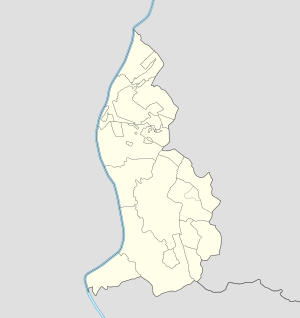 Nendeln Locator map of Nendeln in Liechtenstein | |
| Coordinates: 47°12′N 9°33′E / 47.200°N 9.550°ECoordinates: 47°12′N 9°33′E / 47.200°N 9.550°E | |
| Country |
|
| Electoral district |
|
| Municipality |
|
| Elevation | 450 m (1,480 ft) |
| Population (2003) | |
| • Total | 1,357[1] |
| Time zone | CET (UTC+1) |
| • Summer (DST) | CEST (UTC+2) |
| Postal code | 9492 |
| Area code(s) | (+423) ... |
Nendeln is a village of Liechtenstein, located in the municipality of Eschen.
Geography
The village is located in north-central Liechtenstein, on the main road Schaan-Schaanwald that links the country with Buchs (Switzerland) and Feldkirch (Austria). Closer villages to Nendeln are Schaanwald, Mauren, Eschen and Planken.[2]
Transport
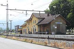
As rail transport, Nendeln counts a train station on the Feldkirch-Buchs line.
References
- ↑ (German) 2003 population statistics of Eschen municipality
- ↑ 240046176 Nendeln on OpenStreetMap
External links
![]() Media related to Nendeln at Wikimedia Commons
Media related to Nendeln at Wikimedia Commons
Villages of Liechtenstein (hamlets of the 11 municipalities) | |||
|---|---|---|---|
This article is issued from Wikipedia - version of the 10/9/2016. The text is available under the Creative Commons Attribution/Share Alike but additional terms may apply for the media files.