Shamrock Airport
Coordinates: 42°05′42.15″N 84°14′26.81″W / 42.0950417°N 84.2407806°W
| Shamrock Airport | |||||||||||
|---|---|---|---|---|---|---|---|---|---|---|---|
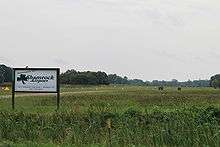 Airport entrance viewed from Wamplers Lake Rd. | |||||||||||
| IATA: none – ICAO: none – FAA LID: 6G8 | |||||||||||
| Summary | |||||||||||
| Airport type | Public | ||||||||||
| Owner | Dr. Deano Smith | ||||||||||
| Operator | Dr. Deano Smith | ||||||||||
| Serves | Brooklyn, Michigan | ||||||||||
| Elevation AMSL | 995 ft / 303 m | ||||||||||
| Coordinates | 42°05′42.15″N 84°14′26.81″W / 42.0950417°N 84.2407806°W | ||||||||||
| Runways | |||||||||||
| |||||||||||
|
Source: FAA Airports GIS[1] | |||||||||||
Shamrock Airport is located in Brooklyn, Michigan. It is owned and operated by Deano Smith. It has an FAA identifier of 6G8. It is at an elevation of 995 feet. It has one runway with a grass surface and a length of 2,822 feet designated 01/19.[2] The airfield opened in December 1975, although the sign at the entrance of the airport says it was established on the bicentennial date of July 4, 1976. Airport facilities include parking hangars and tiedowns.[3]

Hangar area
References
This article is issued from Wikipedia - version of the 6/23/2014. The text is available under the Creative Commons Attribution/Share Alike but additional terms may apply for the media files.