Qala Phusa (Larecaja)
For the mountain in the Franz Tamayo Province, La Paz Department, Bolivia, see Qala Phusa.
| Qala Phusa | |
|---|---|
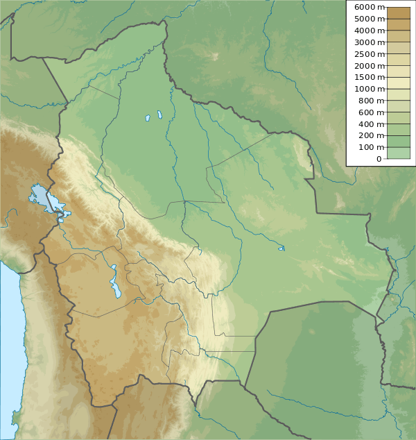 Qala Phusa Location within Bolivia | |
| Highest point | |
| Elevation | 4,884 m (16,024 ft) [1] |
| Coordinates | 15°45′43″S 68°33′44″W / 15.76194°S 68.56222°WCoordinates: 15°45′43″S 68°33′44″W / 15.76194°S 68.56222°W |
| Geography | |
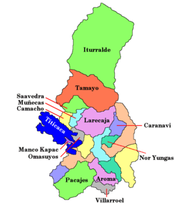
| Location |
Bolivia, La Paz Department, Larecaja Province |
| Parent range | Andes |
Qala Phusa (Aymara qala stone, phusa siku,[2][3] "stone siku", also spelled Calapusa) is a 4,884-metre (16,024 ft) high mountain in the Andes of Bolivia. It is situated in the La Paz Department, Larecaja Province, Sorata Municipality. Qala Phusa lies north of the Janq'u Uma-Illampu massif of the Cordillera Real, northwest of the mountain Wila Quta and southeast of Llawi Imaña.[4][5]
References
- ↑ Cordillera Real Nord (Illampu) - Bolivien - 1:50 000 Deutscher Alpenverein 1987
- ↑ Radio San Gabriel, "Instituto Radiofonico de Promoción Aymara" (IRPA) 1993, Republicado por Instituto de las Lenguas y Literaturas Andinas-Amazónicas (ILLLA-A) 2011, Transcripción del Vocabulario de la Lengua Aymara, P. Ludovico Bertonio 1612 (Spanish-Aymara-Aymara-Spanish dictionary)
- ↑ Teodoro Marka M., Nociones Basicas de Lengua Aymara
- ↑ Bolivian IGM map 1:50,000 Sorata 5846-I
- ↑ "Sorata". INE, Bolivia. Archived from the original on October 6, 2014. Retrieved December 5, 2014.
This article is issued from Wikipedia - version of the 7/21/2016. The text is available under the Creative Commons Attribution/Share Alike but additional terms may apply for the media files.