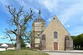
Choue
| Choue | ||
|---|---|---|
 | ||
| ||
 Choue | ||
|
Location within Centre-Val de Loire region  Choue | ||
| Coordinates: 47°59′57″N 0°55′46″E / 47.9992°N 0.9294°ECoordinates: 47°59′57″N 0°55′46″E / 47.9992°N 0.9294°E | ||
| Country | France | |
| Region | Centre-Val de Loire | |
| Department | Loir-et-Cher | |
| Arrondissement | Vendôme | |
| Canton | Mondoubleau | |
| Intercommunality | Collines du Perche | |
| Government | ||
| • Mayor (2014–2020) | François Gaullier | |
| Area1 | 37.39 km2 (14.44 sq mi) | |
| Population (2013)2 | 529 | |
| • Density | 14/km2 (37/sq mi) | |
| Time zone | CET (UTC+1) | |
| • Summer (DST) | CEST (UTC+2) | |
| INSEE/Postal code | 41053 / 41170 | |
| Elevation |
112–212 m (367–696 ft) (avg. 136 m or 446 ft) | |
|
1 French Land Register data, which excludes lakes, ponds, glaciers > 1 km² (0.386 sq mi or 247 acres) and river estuaries. 2 Population without double counting: residents of multiple communes (e.g., students and military personnel) only counted once. | ||

Choue is a commune in the Loir-et-Cher department of central France.
Population
| Historical population | ||
|---|---|---|
| Year | Pop. | ±% |
| 1793 | 1,272 | — |
| 1806 | 1,149 | −9.7% |
| 1821 | 1,208 | +5.1% |
| 1831 | 1,122 | −7.1% |
| 1841 | 1,084 | −3.4% |
| 1851 | 1,047 | −3.4% |
| 1861 | 1,002 | −4.3% |
| 1872 | 954 | −4.8% |
| 1881 | 1,173 | +23.0% |
| 1891 | 1,034 | −11.8% |
| 1901 | 972 | −6.0% |
| 1911 | 936 | −3.7% |
| 1921 | 895 | −4.4% |
| 1931 | 832 | −7.0% |
| 1946 | 743 | −10.7% |
| 1954 | 796 | +7.1% |
| 1962 | 692 | −13.1% |
| 1975 | 512 | −26.0% |
| 1982 | 562 | +9.8% |
| 1990 | 578 | +2.8% |
| 1999 | 544 | −5.9% |
| 2008 | 530 | −2.6% |
| 2013 | 529 | −0.2% |
See also
References
| Wikimedia Commons has media related to Choue. |
This article is issued from Wikipedia - version of the 11/12/2016. The text is available under the Creative Commons Attribution/Share Alike but additional terms may apply for the media files.