Roissard
| Roissard | |
|---|---|
|
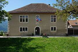
Town hall | |
 Roissard | |
|
Location within Auvergne-Rhône-Alpes region  Roissard | |
| Coordinates: 44°52′59″N 5°38′26″E / 44.8831°N 5.6406°ECoordinates: 44°52′59″N 5°38′26″E / 44.8831°N 5.6406°E | |
| Country | France |
| Region | Auvergne-Rhône-Alpes |
| Department | Isère |
| Arrondissement | Grenoble |
| Canton | Monestier-de-Clermont |
| Intercommunality | Canton de Monestier de Clermont |
| Government | |
| • Mayor (2014–2020) | Christophe Drure |
| Area1 | 14 km2 (5 sq mi) |
| Population (2011)2 | 250 |
| • Density | 18/km2 (46/sq mi) |
| Time zone | CET (UTC+1) |
| • Summer (DST) | CEST (UTC+2) |
| INSEE/Postal code | 38342 / 38650 |
| Elevation | 486–1,800 m (1,594–5,906 ft) |
|
1 French Land Register data, which excludes lakes, ponds, glaciers > 1 km² (0.386 sq mi or 247 acres) and river estuaries. 2 Population without double counting: residents of multiple communes (e.g., students and military personnel) only counted once. | |
Roissard is a commune in the Isère department in southeastern France.
Population
| Historical population | ||
|---|---|---|
| Year | Pop. | ±% |
| 1793 | 323 | — |
| 1806 | 344 | +6.5% |
| 1821 | 333 | −3.2% |
| 1831 | 381 | +14.4% |
| 1841 | 372 | −2.4% |
| 1851 | 383 | +3.0% |
| 1861 | 359 | −6.3% |
| 1872 | 359 | +0.0% |
| 1881 | 348 | −3.1% |
| 1891 | 281 | −19.3% |
| 1901 | 222 | −21.0% |
| 1911 | 201 | −9.5% |
| 1921 | 179 | −10.9% |
| 1931 | 167 | −6.7% |
| 1946 | 184 | +10.2% |
| 1954 | 177 | −3.8% |
| 1962 | 137 | −22.6% |
| 1968 | 136 | −0.7% |
| 1975 | 95 | −30.1% |
| 1982 | 141 | +48.4% |
| 1990 | 199 | +41.1% |
| 1999 | 193 | −3.0% |
| 2006 | 217 | +12.4% |
| 2011 | 250 | +15.2% |
See also
References
| Wikimedia Commons has media related to Roissard. |
This article is issued from Wikipedia - version of the 10/28/2016. The text is available under the Creative Commons Attribution/Share Alike but additional terms may apply for the media files.